You are currently browsing the tag archive for the ‘Entiat’ tag.
Alder Ridge – Mountain Bike – September 15, 2012
This mountain bike ride to Alder Ridge (trail 1523) was actually “Plan B.” Our intended ride was Chickamin Tie (trail 1561) via Minnow Ridge (trail 1524). Although the Chickamin trails were open when we checked, they were closed at some point before we arrived at the trailhead. The closures are/were due to extensive forest fire activity in the area.
The Alder Ridge trailhead is located just down the road from the Chickamin trails. This is near Lake Wenatchee, WA. To get there, turn off Highway 2 onto Highway 207, then take the Chiwawa River Road to the well-marked trailhead. This general area is called the Entiat/Mad River/Lower Chiwawa area.
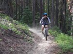
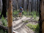
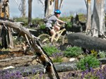
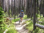
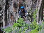
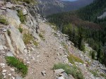
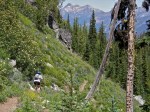
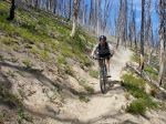
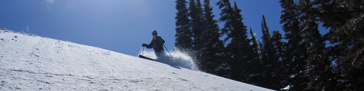
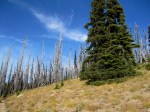
This was a solid day trip and worthy of a repeat. We started at 2400 ft and climbed steadily to a high point of 6200 ft in about 8 1/2 miles. The singletrack tread was mostly smooth toward the bottom and a bit more rocky toward the top. It was “steepish” but mostly “rideable.” (Subjective, I know!) I felt strong and I didn’t have to get off my bike too many times 🙂 . Due to dry conditions, the trail was sandy in places, but not bad. Dust…yes, there was plenty of that. The descent was a blast and over too fast!
This is a multiple use trail system…which means that our fresh air was briefly fouled with the toxic fumes of several motorcycles on the ascent. (Cough, cough – deep, forceful exhales!!) That was the only negative part of the trip. Fortunately, the motor traffic was probably “light” due to the fire closures.
Our biking group of 3 vegans and 1 omnivore also met a pair of hunters. They seemed nice enough, though I’ll never understand how anyone can take pleasure in killing a deer.
After that, I rode on, repeating silently in my mind over and over…
“I manifest good luck to the animals in the forest.”
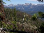
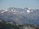
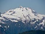
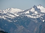
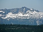
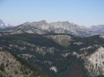
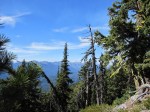
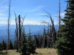
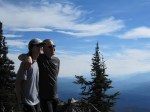
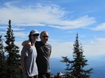
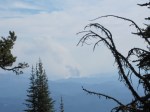
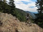
Click on an image to enlarge and view the photos in a gallery. In the photos, you will see maps of the area, views of Glacier Peak, and views from our high point of 6200 ft. (We didn’t quite make it to Mad Lake.) We photographed the Basalt Peak fire to the north and the Wenatchee fires to the south.
-

- Alder Ridge Trailhead
-

- Chiwawa River Valley

-

- Devils Backbone, Entiat, Mad River, Lower Chiwawa Sign
-
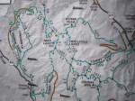
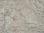
- Alder Ridge Trail Map
-

- Green Trail Map #146 – Plain, WA

-

- Basalt Peak Fire
-

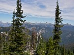
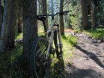
- Alder Ridge Trail
-

- Alder Ridge Trail
-
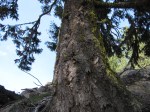
- Downy Woodpecker
-
- Glacier Peak
-

- Glacier Peak
-
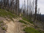
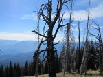
- Old Forest Fire on Alder Ridge
-
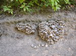
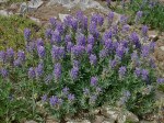
- What kind of mushroom?
-
- Santa Cruzin’ the Forest
-

- Wenatchee Fire View 1
-
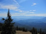
- Wenatchee Fire View 2
-

- Wenatchee Fire View 3
-
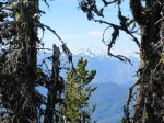
- Glacier Peak
-
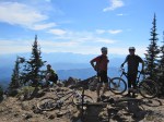
- The Boys at 6200 ft
-

- Basalt Peak Fire
-

- Glacier Peak & Basalt Peak Fire
-

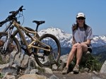
- Elisa & Eric
-
- Elisa & Eric
-
- Elisa & Eric

-

- Flat Tire on Alder Ridge
-

- Burned Tree
-

- Wenatchee Fire
-
- Wenatchee Fire (Zoom)
-
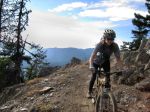
- Elisa at Alder Ridge (Photo Credit: Ken H)
-
- Elisa at Alder Ridge (Photo Credit: Ken H)

Klone Peak – Mountain Biking – July 18, 2009
Klone Peak (6820 ft) is located in the Entiat mountains in Washington. Trail 1425 (Tommy Creek) is open to bikes and the tread is mostly smooth/sandy for the 5.6 mile gradual climb (partly through burned forest).
The view of Glacier Peak from the top is stunning. This impressive area (including the North Entiat Mountains & Chelan Mountains) is actually home to many >8,000 ft and >9,000 ft peaks…Magnificent!
Klone Peak is on Green Trail Map #146 (Plain). Drive up the Entiat River Road (#51) from Entiat. Just past Silver Falls Campground, turn left (west) on (gravel) Road #5605 and drive to the road’s end (trailhead @ 4400 ft).
(Click on an image to enlarge and view in a photo gallery.)