You are currently browsing the tag archive for the ‘Bike Tracks App’ tag.
Friday July 5, 2013
For this mountain bike trip, we started from Wenatchee, WA and drove south on Hwy 97 (Blewett Hwy) for about 45 minutes. We turned onto Iron Creek Road #9714, located south of Swauk Pass and the old Blewett Pass Road #9715. The trailhead for Iron Cr/Bear Cr Trail #1351 is at the end of Iron Creek Road.
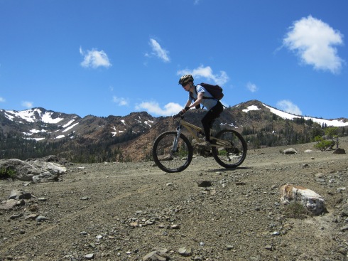
Our final destination for the day was the 6000 ft pass between Earl Peak and Navaho Peak, where you are treated to views of the Stuart Range.
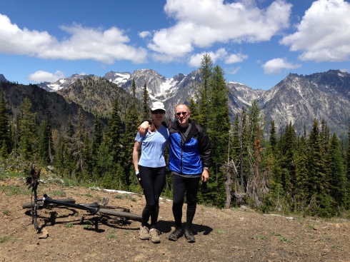
Elisa & Eric at the 6000 ft pass. (Stuart Range)
TRIP SEGMENTS: (This trip is an “out & back”)
- Iron Creek portion of Iron Cr/Bear Cr Trail #1351, to the junction with Teanaway Ridge Trail #1364 (1.8 miles)
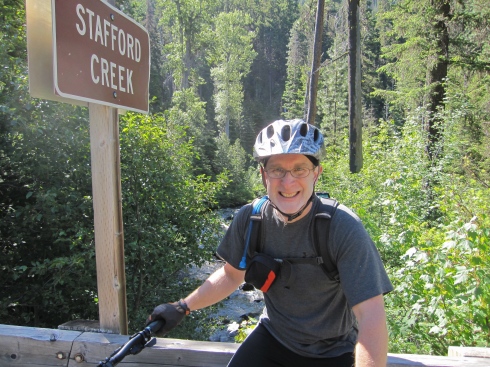
- Bear Creek portion of Iron Cr/Bear Cr Trail, to Stafford Creek Road #9713 (3.5 miles)
- Stafford Creek Rd to Stafford Creek Trail #1359 (about 1 mile)
- Stafford Creek Trail to the junction with Standup Creek Trail #1369 (4.8 miles)
- Continue on Stafford Cr Trail to the pass (1.2 miles)
- Reverse order back to the car (~12.3 miles)
——————————————–
SEGMENT 1 – Iron Creek portion of Iron Cr/Bear Cr Trail
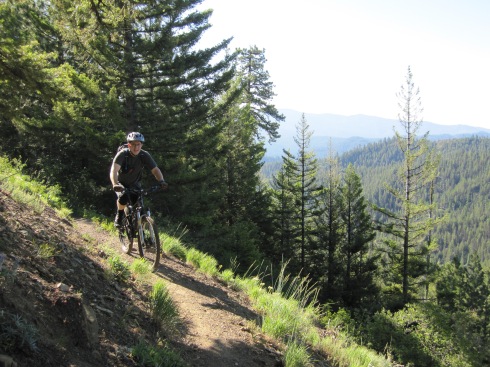
From the trailhead, at 8:00 AM, we were surprised to notice that it was only about 33 degrees Fahrenheit. But, I was able to start out in just my short-sleeved shirt because it warmed up fast.
The 1.8 mile Iron Creek portion of the Iron Cr/Bear Cr Trail is an easy climb on smooth ground. It starts at 3800 ft and ends at 4400 ft. For the most part, the trail hugs a somewhat steep sidehill. In one place you definitely don’t want to fall off the side. The trail is wide, so you’d have to really screw up big to get into trouble.
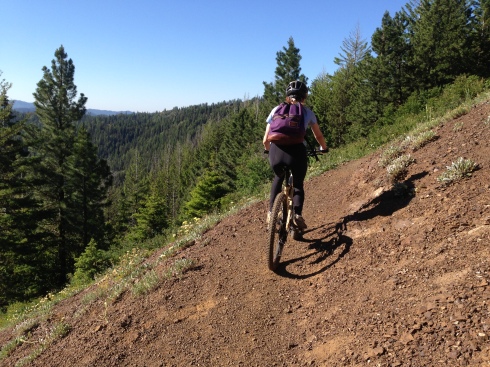
Elisa climbs Iron Creek/Bear Creek Trail
Eric approaches the junction with Teanaway Ridge Trail.
Flora
SEGMENT 2 – Bear Creek portion of Iron Cr/Bear Cr Trail, to Stafford Creek Rd
From the 4400 ft saddle, the Bear Creek portion of Iron Cr/Bear Cr Trail is all downhill. The first half mile is pretty steep, but rideable. I counted about 9 little creek crossings as we screamed the rest of the way down to the Stafford Creek Rd, at 3200 ft. This was 1200 ft of grinnin’ good fun!
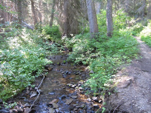
Bear Creek and Bear Creek Trail
Elisa at the Trailhead for Bear Cr/Iron Cr Trail, on Stafford Creek Rd
SEGMENT 3 – Stafford Creek Rd to Stafford Creek Trail #1359 (about 1 mile)
This is a short section of road connecting the 2 trailheads. It’s a descent of about 100 ft in a little under a mile.
Eric at the trailhead for Stafford Creek
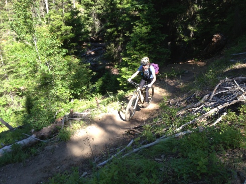
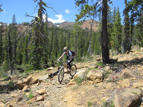
SEGMENT 4 – Stafford Creek Trail to the junction with Standup Creek Trail #1369
The Stafford Creek Trail starts at 3100 ft. The trail surface is quite varied as it parallels Stafford Creek. First, it’s nice and smooth. Later…it’s not so nice and rocky. It’s a real mixed bag of riding and pushing. In general, the higher up, the rockier it gets. This section of trail is 4.8 miles long and ends at 5000 ft near a wide meadow/camp.
Elisa on the smooth section of Stafford Creek Trail

Who put all these rocks in the trail?!
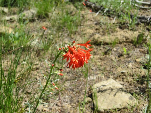
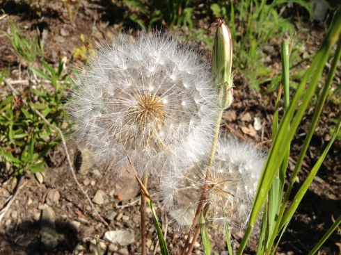
Scarlet Gilia

Navaho Peak (7223 ft)
near Earl Peak
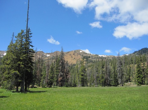
Meadow/Camp near 5000 ft
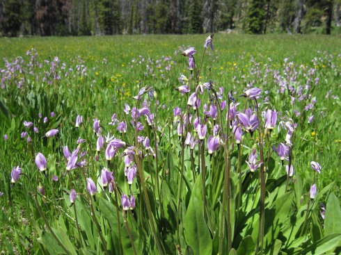
Jeffrey’s Shooting Star
SEGMENT 5 – Continue on Stafford Cr Trail to the pass
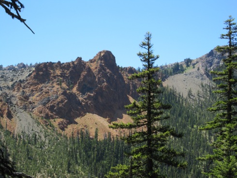
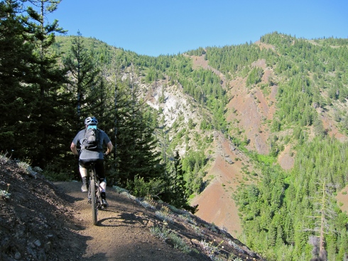
Another 1000 ft is gained in 1.2 miles to culminate at a 6000 ft pass. We were glad to get a break from pushing and get back to pedaling! The desolate Serpentinite landscape seemed out of place, and the surface was hard and gritty.
The views at the top were worth the effort to get there. Mt Stuart (9415 ft) is the 7th highest peak in WA.
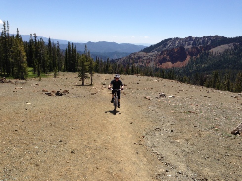
Eric climbing the Serpentinite landscape
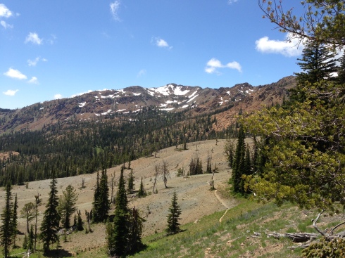
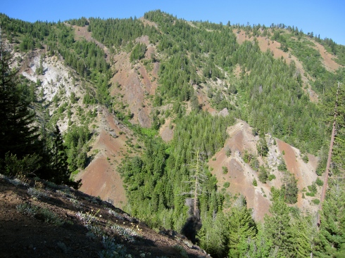
Just below the 6000 ft pass– looking past wildflowers (foreground), Serpentinite landscape (middle), over to the Earl Peak ridge (far).

Stuart Range

Stuart Range
SEGMENT 6 – Reverse order back to the car
Elisa descends the Serpentinite landscape
Fortunately, we were able to ride down much of the rocky terrain that we had to push our bikes up. Yay!
On very loose rock, you can’t go too slow or else every rock will try to throw you. There’s a very fine ‘sweet spot.’ It’s actually kind of fun…in a weird, slightly out-of-control way!
Elisa descends on loose rock
Of course, the real fun began once we got below the upper rockier slopes and back onto the smooth trail. This is what it’s all about!
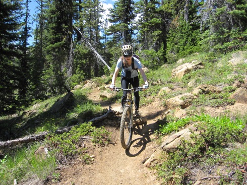
Elisa descends smooth trail
Eric got a flat tire partway down the Stafford Creek Trail. While he fixed the flat, I had the opportunity to watch a butterfly go from one Tiger Lily to the next.
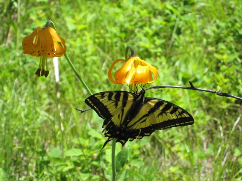
Butterfly on Tiger Lily
Once we descended Stafford Creek Trail, we had a pleasant climb back up to Teanaway Ridge. Before getting to the top, we had to get off our bikes one more time, to walk the ~1/2 mile extra steep section that I mentioned earlier. A shot of caffeine helped get me through the last push with extra energy to spare!
Here’s the Iron Creek Valley. Almost back to the car…
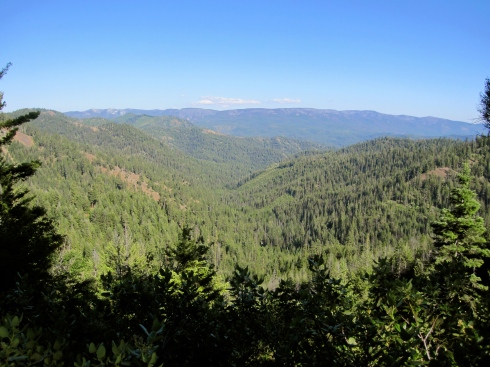
Iron Creek Valley from Iron Cr/Bear Cr Trail
Eric descends the Iron Creek portion of the Iron Cr/Bear Cr Trail, at the “don’t fall” section.
The Iron Cr/Bear Cr Trail cuts horizontally across that slope ahead. Can you see it?
Would I repeat this trip?
YES!
————————————
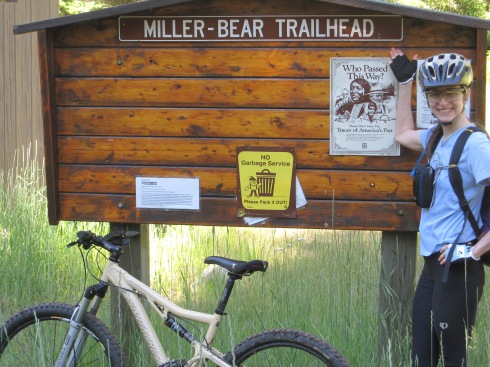
TRIP STATS: (Using the Bike Tracks App for iPhone)
- Total Distance = 24.1 miles
- Total Vertical = 10,543 ft (climb 5321 ft, descend 5223 ft)
- Elevation = 6003 ft highest, 2938 ft lowest
- Time = 9 hr, 22 min (start 8:00 AM, finish 5:20 PM)
- Eric had to change his flat rear tire at 2:45 PM during the descent.
MAPS USED:
- Green Trails Mount Stuart, WA – No. 209
- Green Trails Liberty, WA – No. 210
Sunday June 16, 2013 – Port Gamble Trails
Today we drove to Edmonds, parked the car, and rode our mountain bikes to the Edmonds ferry terminal. For each passenger + bicycle the cost was $8.70 to ride the ferry over to Kingston. Cyclists are special…they get to load first!

Eric waiting for the ferry.

Our ferry coming into Edmonds.

Excited to try out some new trails.
Why were we smiling? Because the purpose of our trip was to do some exploring on the Kitsap Peninsula. Eric wanted to check out the Port Gamble Trails.
To get to the trail system, we rode ~8.5 miles on roads (mostly uphill):
- Kingston ferry terminal to NE West Kingston Rd
- NE West Kingston Rd to Miller Bay Rd NE
- Miller Bay Rd NE to NE Gunderson Rd
- NE Gunderson Rd, across Bond Rd NE (Hwy 307) to Stottlemeyer Rd NE
- The south entrance to the Port Gamble Trails is located on Stottlemeyer Rd, past Gracey Trail Ln NE

NE Gunderson Rd

We had to climb a 10% grade.

We entered the Port Gamble Trails at the south end.
Click here to see the Port Gamble Recreation Map.
Initially, the trails were smooth, somewhat sandy, and exposed to the sun. It reminded us a little of mountain biking in Bend, OR.
Soon after, we were enveloped by lush forest. The canopy became quite thick, and the riding surface was a little more rooty. We gradually made our way north, grinning all the way.

Alder Forest

Twisted Sister Trail

Forbidden Forest

Exiting the Forbidden Forest

I spotted this caterpillar crawling on Eric’s shoulder, so I carefully moved him to this tree.
After riding ~7 miles of fantastic XC trails, we exited the system where Kitsap Ave NE joins Hwy 104. We then rode another ~6.5 miles along Hwy 104 to get back to the Kingston ferry terminal.
When I spotted this sign for CB’s Nuts, I insisted that we stop in for a taste.

CB’s Nuts

We bought a huge bag of hazelnuts for only $6.
Total mileage on the bike = 21.9 miles (~15 miles road, ~7 miles trails)
Total vertical = 3444 ft (1701 ft climbing, 1743 ft downhill)
Trip duration = 3 hours, 55 minutes (starting at ~10:45 AM and ending at ~2:45 PM)
The above figures were obtained from my Bike Tracks App. I started it when we got off the ferry at Kingston and stopped it when we completed our clockwise loop back at the Kingston ferry terminal.
I’m including our trip data because this is a trip definitely worth repeating!

Leaving the Kingston ferry dock.
One reason that we decided to take this adventure on this particular day was to visit my uncle Jeff at the Edmonds Art Festival. He is a comedic artist. Check out his work: Art That Makes You Laugh, by Jeff Leedy.

Jeff Leedy

Leedy Art
No active day would be complete without a satisfying, quick meal. I’d like to make a plug for Baja Fresh, a vegan-friendly fast food restaurant.
We order the “bare” veggie burrito (i.e. no tortilla and served over romaine lettuce instead), without cheese, without sour cream, and with extra guacamole. Each order comes with a small basket of chips. From the condiment bar, we select fresh cilantro, lime, and various hot sauces.

Baja Fresh Mexican Grill – Everett, WA

Baja Fresh Bare-Style Vegan Burrito
That’s a wrap to our fun day Sunday!