You are currently browsing the tag archive for the ‘meadow’ tag.
Saturday, August 24, 2013 – Mountain Biking
This was our second time riding the Crystal Mountain Trail #1163, to the top of the Crystal Mountain ski resort.
The first time we rode there was July 31, 2010. That was one of those picture-perfect days! The views of Mt Rainier are not to be missed!
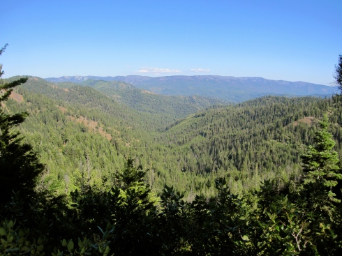
Despite having a summer strung together with days and days of clear skies, the weather on this particular Saturday was not so cooperative. It was raining when we left the house. At the trailhead it was dry, but cloudy. We saw initial glimmers of blue sky as we climbed the forest, but by the time we arrived at the top, the fog was thick! And, Brrrr!!– it was not warm! Our fingers got cold on the descent.
We drive here via Enumclaw, WA and Hwy 410 (Chinook Pass Hwy), which follows the White River. Turn off Hwy 410 at Rd #7190 (Crystal Mountain Blvd) and find the trailhead for Crystal Mountain Trail #1163 adjacent to Sand Flat Horse Camp. It is located about 2 miles short of the the ski resort itself.
This trip is a relatively short, “out-and-back” ride for us. We turn around at the top of the Mt Rainier Gondola/Summit House. Note that Trail #1163 does continue down from that highpoint (6872 ft) to intersect with other trails.
In a nutshell, this trail simply goes up and up and up for about 3000 ft. Consider this climb “interval training” because you won’t stay in your Zone 2. The tread is basically smooth, with some sections of jagged rocks (not too many) and some sandy patches. It’s quite rideable throughout. The descent is screamin’ fast!
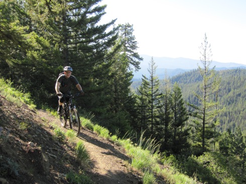
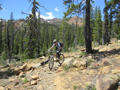
CLIMBING THE FOREST–> Switchbacks through trees and open slide paths of huckleberry bushes.

Ascending forest – August 24, 2013

Ascending forest – August 24, 2013

Blue skies on July 31, 2010
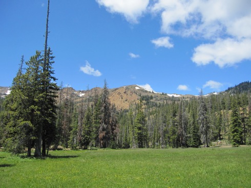
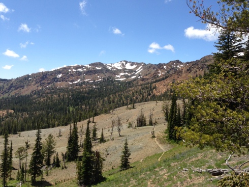
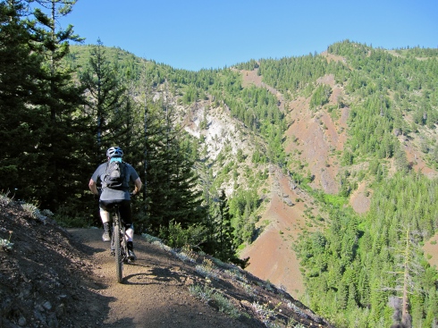
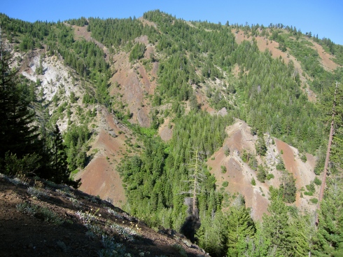
CLIMBING CRYSTAL MOUNTAIN RIDGE–> At times, the trail hugs a steep sidehill. It’s not too “airy,” but you do need to focus in couple places. The trail up the ridge also traverses a wide wildflower meadow.
From the ridge, the BIG view is Mt Rainier. The White River is quite impressive as well.

Ridge climb – July 31, 2010

Meadow – July 31, 2010

Mt Rainier from Crystal Mountain Ridge – July 31, 2010

Eric – July 31, 2010

White River & clouds hiding Mt Rainier – August 24, 2013

White River & Mt Rainier – July 31, 2010

Looking east – July 31, 2010

Elisa – July 31, 2010

Elisa – July 31, 2010
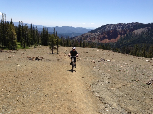
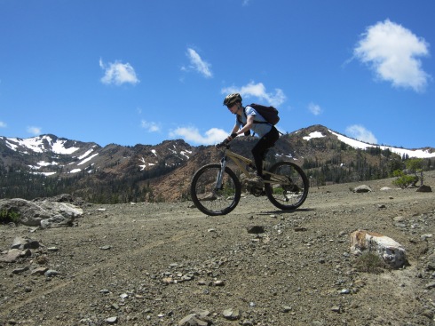
ENTERING THE CRYSTAL MOUNTAIN SKI AREA–> Singletrack trail is replaced by a rocky road on the final uphill traverse to the top of the Mt Rainier Gondola and Summit House.

Headed toward the Northway Chairlift – August 24, 2013

Aster & Fireweed – August 24, 2013

Eric wearing his #NSNG technical tee – August 24, 2013

Looking into the ski area – August 24, 2013

Crystal Mountain ski area map – August 24, 2013
THE TOP–> Views of fog!

Mt Rainier Gondola & the top of the Rainier Express chair – August 24, 2013

If you don’t want to power yourself to the top, you can pay $20 to ride the gondola.
Here is a link to the Crystal Mountain Summer Map. Note that this map calls the north section of the Crystal Mountain Trail #1163, “Northway Trail.”
—————————————
TRIP STATS: (Using the Bike Tracks App for iPhone)
- Total Distance = 11.6 miles
- Total Vertical = 5991 ft (climb 3053 ft, descend 2938 ft)
- Elevation = 6849 ft highest, 3818 ft lowest
- Time = 3 hrs, 39 min (start 11:10 AM, finish 2:46 PM)
MAPS USED:
FOOD CONSUMED ON TRAIL:
- Water + 1 SaltStick
- We didn’t even eat one huckleberry although the bushes were packed!
Friday July 5, 2013
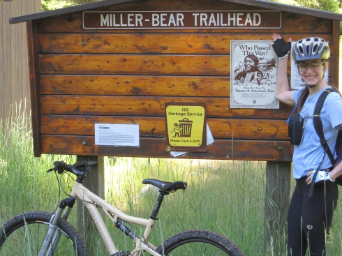
For this mountain bike trip, we started from Wenatchee, WA and drove south on Hwy 97 (Blewett Hwy) for about 45 minutes. We turned onto Iron Creek Road #9714, located south of Swauk Pass and the old Blewett Pass Road #9715. The trailhead for Iron Cr/Bear Cr Trail #1351 is at the end of Iron Creek Road.
Our final destination for the day was the 6000 ft pass between Earl Peak and Navaho Peak, where you are treated to views of the Stuart Range.
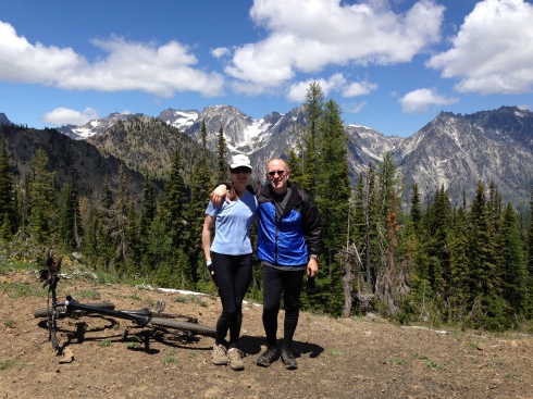
Elisa & Eric at the 6000 ft pass. (Stuart Range)
TRIP SEGMENTS: (This trip is an “out & back”)
- Iron Creek portion of Iron Cr/Bear Cr Trail #1351, to the junction with Teanaway Ridge Trail #1364 (1.8 miles)
- Bear Creek portion of Iron Cr/Bear Cr Trail, to Stafford Creek Road #9713 (3.5 miles)
- Stafford Creek Rd to Stafford Creek Trail #1359 (about 1 mile)
- Stafford Creek Trail to the junction with Standup Creek Trail #1369 (4.8 miles)
- Continue on Stafford Cr Trail to the pass (1.2 miles)
- Reverse order back to the car (~12.3 miles)
——————————————–
SEGMENT 1 – Iron Creek portion of Iron Cr/Bear Cr Trail
From the trailhead, at 8:00 AM, we were surprised to notice that it was only about 33 degrees Fahrenheit. But, I was able to start out in just my short-sleeved shirt because it warmed up fast.
The 1.8 mile Iron Creek portion of the Iron Cr/Bear Cr Trail is an easy climb on smooth ground. It starts at 3800 ft and ends at 4400 ft. For the most part, the trail hugs a somewhat steep sidehill. In one place you definitely don’t want to fall off the side. The trail is wide, so you’d have to really screw up big to get into trouble.
Elisa climbs Iron Creek/Bear Creek Trail
Eric approaches the junction with Teanaway Ridge Trail.
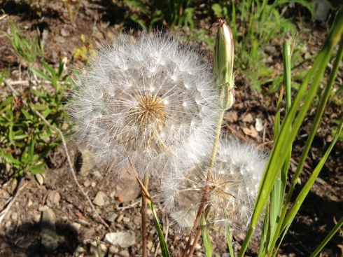
Flora
SEGMENT 2 – Bear Creek portion of Iron Cr/Bear Cr Trail, to Stafford Creek Rd
From the 4400 ft saddle, the Bear Creek portion of Iron Cr/Bear Cr Trail is all downhill. The first half mile is pretty steep, but rideable. I counted about 9 little creek crossings as we screamed the rest of the way down to the Stafford Creek Rd, at 3200 ft. This was 1200 ft of grinnin’ good fun!
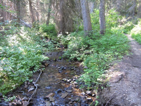
Bear Creek and Bear Creek Trail
Elisa at the Trailhead for Bear Cr/Iron Cr Trail, on Stafford Creek Rd
SEGMENT 3 – Stafford Creek Rd to Stafford Creek Trail #1359 (about 1 mile)
This is a short section of road connecting the 2 trailheads. It’s a descent of about 100 ft in a little under a mile.
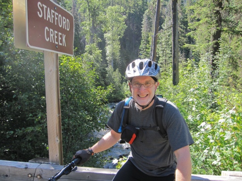
Eric at the trailhead for Stafford Creek
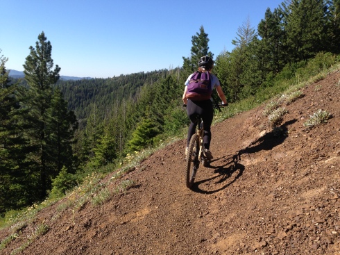
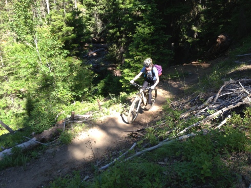
SEGMENT 4 – Stafford Creek Trail to the junction with Standup Creek Trail #1369
The Stafford Creek Trail starts at 3100 ft. The trail surface is quite varied as it parallels Stafford Creek. First, it’s nice and smooth. Later…it’s not so nice and rocky. It’s a real mixed bag of riding and pushing. In general, the higher up, the rockier it gets. This section of trail is 4.8 miles long and ends at 5000 ft near a wide meadow/camp.
Elisa on the smooth section of Stafford Creek Trail

Who put all these rocks in the trail?!
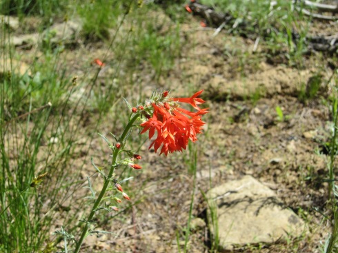
Scarlet Gilia

Navaho Peak (7223 ft)
near Earl Peak
Meadow/Camp near 5000 ft
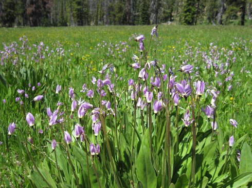
Jeffrey’s Shooting Star
SEGMENT 5 – Continue on Stafford Cr Trail to the pass
Another 1000 ft is gained in 1.2 miles to culminate at a 6000 ft pass. We were glad to get a break from pushing and get back to pedaling! The desolate Serpentinite landscape seemed out of place, and the surface was hard and gritty.
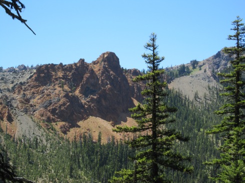
The views at the top were worth the effort to get there. Mt Stuart (9415 ft) is the 7th highest peak in WA.
Eric climbing the Serpentinite landscape
Just below the 6000 ft pass– looking past wildflowers (foreground), Serpentinite landscape (middle), over to the Earl Peak ridge (far).

Stuart Range

Stuart Range
SEGMENT 6 – Reverse order back to the car
Elisa descends the Serpentinite landscape
Fortunately, we were able to ride down much of the rocky terrain that we had to push our bikes up. Yay!
On very loose rock, you can’t go too slow or else every rock will try to throw you. There’s a very fine ‘sweet spot.’ It’s actually kind of fun…in a weird, slightly out-of-control way!
Elisa descends on loose rock
Of course, the real fun began once we got below the upper rockier slopes and back onto the smooth trail. This is what it’s all about!
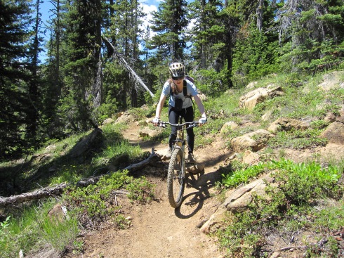
Elisa descends smooth trail
Eric got a flat tire partway down the Stafford Creek Trail. While he fixed the flat, I had the opportunity to watch a butterfly go from one Tiger Lily to the next.
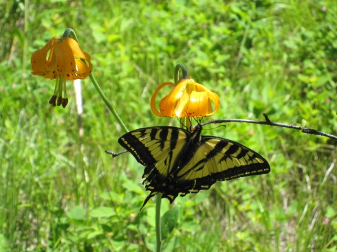
Butterfly on Tiger Lily
Once we descended Stafford Creek Trail, we had a pleasant climb back up to Teanaway Ridge. Before getting to the top, we had to get off our bikes one more time, to walk the ~1/2 mile extra steep section that I mentioned earlier. A shot of caffeine helped get me through the last push with extra energy to spare!
Here’s the Iron Creek Valley. Almost back to the car…
Iron Creek Valley from Iron Cr/Bear Cr Trail
Eric descends the Iron Creek portion of the Iron Cr/Bear Cr Trail, at the “don’t fall” section.
The Iron Cr/Bear Cr Trail cuts horizontally across that slope ahead. Can you see it?
Would I repeat this trip?
YES!
————————————
TRIP STATS: (Using the Bike Tracks App for iPhone)
- Total Distance = 24.1 miles
- Total Vertical = 10,543 ft (climb 5321 ft, descend 5223 ft)
- Elevation = 6003 ft highest, 2938 ft lowest
- Time = 9 hr, 22 min (start 8:00 AM, finish 5:20 PM)
- Eric had to change his flat rear tire at 2:45 PM during the descent.
MAPS USED:
- Green Trails Mount Stuart, WA – No. 209
- Green Trails Liberty, WA – No. 210