You are currently browsing the category archive for the ‘GET OUT & LIVE LIFE’ category.
Saturday, July 27, 2013 – Mountain Biking
We actually planned to ride here last year, but the trails were temporarily closed on the day we picked (due to forest fires in the area.) We rode Alder Ridge trail instead. (Check out the trip report here. It includes images of the fires and a map showing where Minnow Ridge/Chikamin Tie is.)
This time we were good to go. Our friend joined us and even purchased the après ride beverages!
Minnow Ridge Trail #1524 and Chikamin Tie Trail #1561 are located near Lake Wenatchee, WA.
To get here, turn off Highway 2 onto Highway 207, then take the Chiwawa River Road. After passing the trailhead for Alder Ridge, turn onto road #6210.
In less than half mile, the trailhead for Chikamin Tie is on the right. (Road #6210 continues for several miles. Minnow Ridge trail basically parallels the road. Eventually, we crossed the road’s end to access the upper segment of the Chikamin Tie trail.)
The trailhead for Minnow Ridge Trail #1524 is also the trailhead for Chikamin Creek Trail #1534. We did not take that trail, but we talked to 2 motorcyclists who did. They said it has plenty of exposure (no, thanks!), as it contours a steep side hill– but it does offer a loop option for those interested.

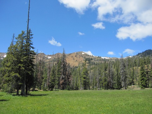
This is not the trail we took, but this trail shares a trailhead with Minnow Ridge Trail.
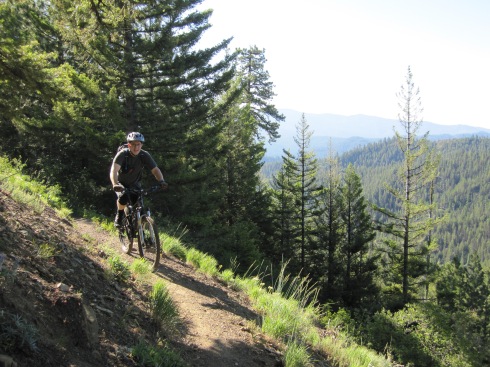
Our trip was an “out and back.” Let’s begin!
SEGMENT 1
Minnow Ridge Trail #1524 starts at 2600 ft. After 3.5 miles and 900 ft net elevation gain of rolling ups and downs, you come to the intersection with Minnow Creek Trail #1539.

Eric consults the map at the first intersection.
SEGMENT 2
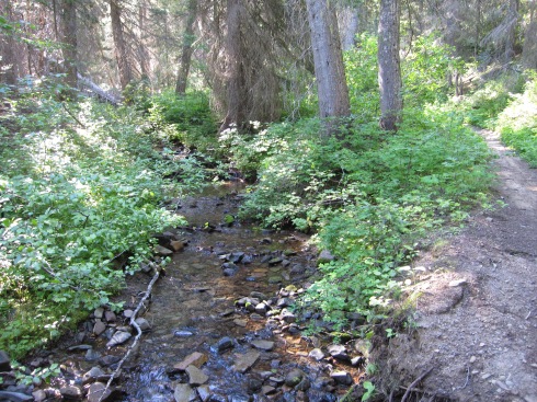
From the intersection, the last 2.3 miles of Minnow Ridge Trail continues up and down to meet up with Chikamin Creek. (The upper end of the Chikamin Creek Trail #1534 is located here.)

Stream crossing

Chikamin Creek
SEGMENT 3
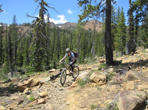
This marks the start of Chikamin Tie Trail #1561. No more ups and down. The trail climbs steadily another 900 ft in 2 miles while it parallels the creek.

Stopping for a snack. If you look closely, you can see evidence of recent fire.
SEGMENT 4
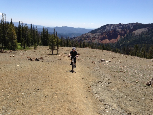
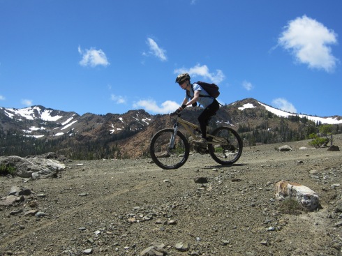
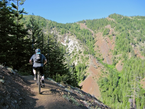
After being in shady forest all morning, we popped into the open sun to cross Road #6210 on our final climb above Chikamin Ridge.

Eric pops onto Road #6210, into the bright sun.
Here’s where we talked to the 2 motorcyclists. One ended up being a WA State Representative from the 12th District, Cary Condotta (R – East Wenatchee). I took his picture as he started up the upper Chikamin Tie trail.

We saw these 2 guys, plus one more small group of motorcyclists on the trail.

Cary Condotta
From here, I started feeling really strong.
It wasn’t because of sleep, because I slept like crap the night before. Maybe it was my “power breakfast” of a green smoothie (with avocado), non-dairy milk latte, and a spoon of peanut butter.
What I started thinking about, though, was an Endurance Planet podcast I heard this week (the episode with Dr. Jason Karp, co-author of Running For Women). In the podcast, I learned that a woman’s athletic performance can be best during the follicular phase of the menstrual cycle- in particular, when estrogen levels reach their peak.
I should be near that peak. Estrogen power!? Could it be? I was leaving the boys behind!
Before crossing a couple granite boulder fields, the trail surface became a bit rutted by motorcycle tires. It wasn’t really that bad, though (for me). It does require good core strength and bike handling to keep the front tire tracking straight.
The granite did require walking the bikes. That was the only real section of “hike-a-bike” during the whole trip.

First of 2 granite boulder fields to cross.

Our friend wanted to take some pictures here. We’re still on our way up, although Eric is posing for the “down.”

Onward and upward…

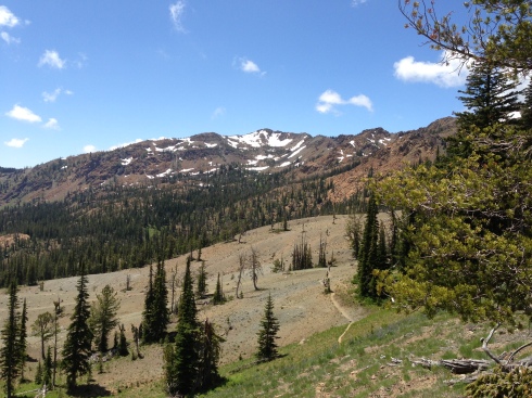
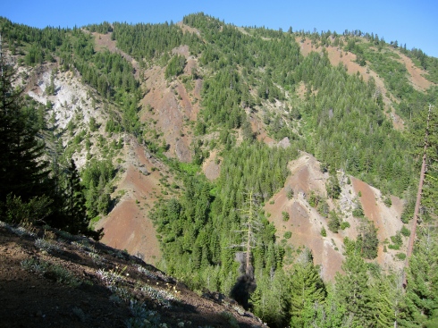
Part of Chikamin Ridge

Crossing the 2nd granite boulder field, below Chikamin Ridge.

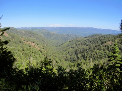
Surrounding hills.

I’m pretty sure that’s Clark Mountain with the snow on it.
Above Chikamin Ridge, the upper Chikamin Tie Trail ended after 4.1 miles at a 3-way intersection (6200 ft).

I asked Eric to take my picture with this sign, and this is what I got. Super close-up!
SEGMENT 5
We were hoping for a spectacular view once we climbed above Chikamin Ridge, but we didn’t get it at the intersection. We’d basically arrived at our turnaround point, but now we were on a quest for views.
We continued onto Pond Camp Tie Trail #1409.2 toward a highpoint on the map at 6500 ft. (After that, the trail would drop down to Pond Meadow.)
Here are the views we got. Okay, but anticlimactic…

Left side of our “view” from the 6500 ft highpoint.

Middle section views from 6500 ft highpoint.
The best was yet to come. The ride back to the car!
While screaming down the trail on the descent, I unofficially named both segments of the Minnow Ridge Trail “Superfun Forest.” The forest floor is basically smooth, with not too many of those switchbacks with the pesky waffle-pattern cement blocks (for the motorcycles.)
This trip is definitely one to repeat. I’d also like to explore a little further, toward Mad Lake/Meadow. This will require getting an earlier start.
The beer at the car really hit the spot. Good times!

Cheers!
————————————
TRIP STATS: (Using the Bike Tracks App for iPhone)
- Total Distance = 24.9 miles
- Total Vertical = 9349 ft (climb 4627 ft, descend 4722 ft)
- Elevation = 6462 ft highest, 2536 ft lowest
- Time = 8 hrs, 7 min (start 9:45 AM, finish 5:45 PM)
MAP USED:
FOOD CONSUMED ON TRAIL:
- Water + SaltSticks
- 1 square homemade Sunflower Butter Energy Bar (GF)
- 2 pieces dried mango
- 3 jumbo black olive
- 4 salted cashews
- 1 energy gel (with caffeine)
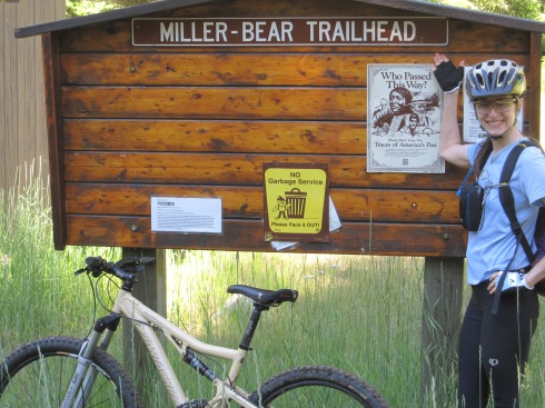
Friday July 5, 2013
For this mountain bike trip, we started from Wenatchee, WA and drove south on Hwy 97 (Blewett Hwy) for about 45 minutes. We turned onto Iron Creek Road #9714, located south of Swauk Pass and the old Blewett Pass Road #9715. The trailhead for Iron Cr/Bear Cr Trail #1351 is at the end of Iron Creek Road.
Our final destination for the day was the 6000 ft pass between Earl Peak and Navaho Peak, where you are treated to views of the Stuart Range.
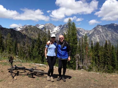
Elisa & Eric at the 6000 ft pass. (Stuart Range)
TRIP SEGMENTS: (This trip is an “out & back”)
- Iron Creek portion of Iron Cr/Bear Cr Trail #1351, to the junction with Teanaway Ridge Trail #1364 (1.8 miles)
- Bear Creek portion of Iron Cr/Bear Cr Trail, to Stafford Creek Road #9713 (3.5 miles)
- Stafford Creek Rd to Stafford Creek Trail #1359 (about 1 mile)
- Stafford Creek Trail to the junction with Standup Creek Trail #1369 (4.8 miles)
- Continue on Stafford Cr Trail to the pass (1.2 miles)
- Reverse order back to the car (~12.3 miles)
——————————————–
SEGMENT 1 – Iron Creek portion of Iron Cr/Bear Cr Trail
From the trailhead, at 8:00 AM, we were surprised to notice that it was only about 33 degrees Fahrenheit. But, I was able to start out in just my short-sleeved shirt because it warmed up fast.
The 1.8 mile Iron Creek portion of the Iron Cr/Bear Cr Trail is an easy climb on smooth ground. It starts at 3800 ft and ends at 4400 ft. For the most part, the trail hugs a somewhat steep sidehill. In one place you definitely don’t want to fall off the side. The trail is wide, so you’d have to really screw up big to get into trouble.
Elisa climbs Iron Creek/Bear Creek Trail
Eric approaches the junction with Teanaway Ridge Trail.
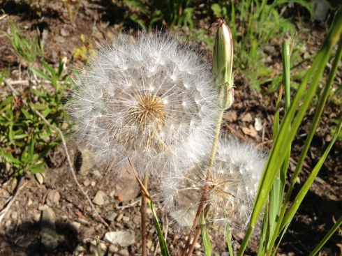
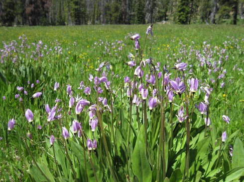
Flora
SEGMENT 2 – Bear Creek portion of Iron Cr/Bear Cr Trail, to Stafford Creek Rd
From the 4400 ft saddle, the Bear Creek portion of Iron Cr/Bear Cr Trail is all downhill. The first half mile is pretty steep, but rideable. I counted about 9 little creek crossings as we screamed the rest of the way down to the Stafford Creek Rd, at 3200 ft. This was 1200 ft of grinnin’ good fun!
Bear Creek and Bear Creek Trail
Elisa at the Trailhead for Bear Cr/Iron Cr Trail, on Stafford Creek Rd
SEGMENT 3 – Stafford Creek Rd to Stafford Creek Trail #1359 (about 1 mile)
This is a short section of road connecting the 2 trailheads. It’s a descent of about 100 ft in a little under a mile.
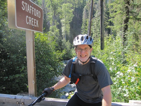
Eric at the trailhead for Stafford Creek
SEGMENT 4 – Stafford Creek Trail to the junction with Standup Creek Trail #1369
The Stafford Creek Trail starts at 3100 ft. The trail surface is quite varied as it parallels Stafford Creek. First, it’s nice and smooth. Later…it’s not so nice and rocky. It’s a real mixed bag of riding and pushing. In general, the higher up, the rockier it gets. This section of trail is 4.8 miles long and ends at 5000 ft near a wide meadow/camp.
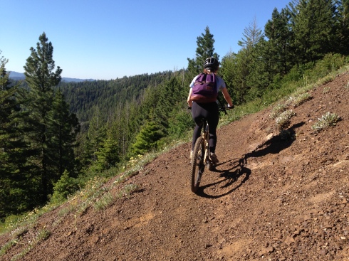
Elisa on the smooth section of Stafford Creek Trail

Who put all these rocks in the trail?!
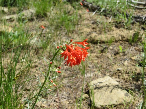
Scarlet Gilia

Navaho Peak (7223 ft)
near Earl Peak
Meadow/Camp near 5000 ft
Jeffrey’s Shooting Star
SEGMENT 5 – Continue on Stafford Cr Trail to the pass
Another 1000 ft is gained in 1.2 miles to culminate at a 6000 ft pass. We were glad to get a break from pushing and get back to pedaling! The desolate Serpentinite landscape seemed out of place, and the surface was hard and gritty.
The views at the top were worth the effort to get there. Mt Stuart (9415 ft) is the 7th highest peak in WA.
Eric climbing the Serpentinite landscape
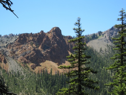
Just below the 6000 ft pass– looking past wildflowers (foreground), Serpentinite landscape (middle), over to the Earl Peak ridge (far).

Stuart Range

Stuart Range
SEGMENT 6 – Reverse order back to the car
Elisa descends the Serpentinite landscape
Fortunately, we were able to ride down much of the rocky terrain that we had to push our bikes up. Yay!
On very loose rock, you can’t go too slow or else every rock will try to throw you. There’s a very fine ‘sweet spot.’ It’s actually kind of fun…in a weird, slightly out-of-control way!
Elisa descends on loose rock
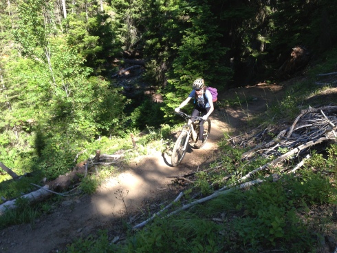
Of course, the real fun began once we got below the upper rockier slopes and back onto the smooth trail. This is what it’s all about!
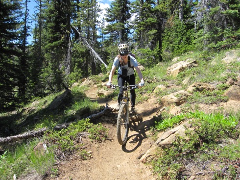
Elisa descends smooth trail
Eric got a flat tire partway down the Stafford Creek Trail. While he fixed the flat, I had the opportunity to watch a butterfly go from one Tiger Lily to the next.
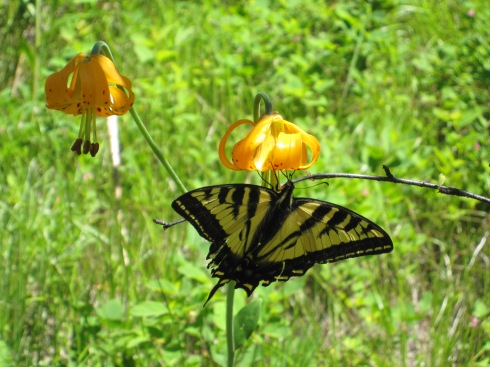
Butterfly on Tiger Lily
Once we descended Stafford Creek Trail, we had a pleasant climb back up to Teanaway Ridge. Before getting to the top, we had to get off our bikes one more time, to walk the ~1/2 mile extra steep section that I mentioned earlier. A shot of caffeine helped get me through the last push with extra energy to spare!
Here’s the Iron Creek Valley. Almost back to the car…
Iron Creek Valley from Iron Cr/Bear Cr Trail
Eric descends the Iron Creek portion of the Iron Cr/Bear Cr Trail, at the “don’t fall” section.
The Iron Cr/Bear Cr Trail cuts horizontally across that slope ahead. Can you see it?
Would I repeat this trip?
YES!
————————————
TRIP STATS: (Using the Bike Tracks App for iPhone)
- Total Distance = 24.1 miles
- Total Vertical = 10,543 ft (climb 5321 ft, descend 5223 ft)
- Elevation = 6003 ft highest, 2938 ft lowest
- Time = 9 hr, 22 min (start 8:00 AM, finish 5:20 PM)
- Eric had to change his flat rear tire at 2:45 PM during the descent.
MAPS USED:
- Green Trails Mount Stuart, WA – No. 209
- Green Trails Liberty, WA – No. 210