North Chuckanut Mountain Trails – Mountain Biking – October 6, 2012
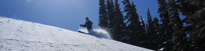
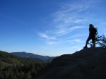
Saturday was a perfect, autumn day for mountain biking in the Chuckanut Mountains. On a clear day like this, we were treated with unobstructed views of Mt Baker from the Cedar Lake viewpoint. This trail system is located just south of the Fairhaven neighborhood of Bellingham, WA. The Chuckanut mountains are tucked between Chuckanut Bay to the west, and I-5 to the east. They reach a high point of about 1850 ft.
Our route: (~12 miles round trip, 4 1/2 hours)
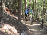
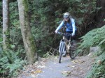
- NORTH CHUCKANUT TRAILHEAD to INTERURBAN TRAIL to LOWER SALAL TRAIL. This section is fun, both up and down. The path is mostly smooth gravel, smooth dirt, and a short section of doubletrack.
- LOWER SALAL TRAIL and SALAL TRAIL to HEMLOCK TRAIL. These trails vary from “rideable rooty/rocky” to highly technical, “get off your bike and push.” NOT for beginners. Be careful if descending this trail. (We saved it for another time.) I’m just imagining what all the roots would be like when wet…
- HEMLOCK TRAIL to PINE LAKE. A relentless climb, with some places where you lose and gain elevation. Get your workout on!
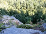
- PINE LAKE to CEDAR LAKE and the CEDAR LAKE VIEWPOINT. We enjoyed watching the dragonflies buzzing over Cedar Lake. Around the lake, you will be off your bike more than on. The view of Mt Baker and the Sisters on a clear day is worth the climb to the viewpoint. Be careful that you don’t fall off the ledge!
- HEMLOCK TRAIL to RAPTOR RIDGE VIEWPOINT. This section is way steep and rocky…Try to enjoy the push! The rocky viewpoint is another no-fall zone. There are no views of Mt Baker from here. Not recommended for small children or clumsy/intoxicated adults!
- RAPTOR RIDGE VIEWPOINT to a new, unmarked trail, down to NORTH LOST LAKE TRAIL. The new, unmarked trail was definitely the highlight of the day 🙂 . This was totally worth the effort to get there…a blast of a descent. Will repeat!!
- NORTH LOST LAKE TRAIL to INTERURBAN TRAIL and NORTH CHUCKANUT TRAILHEAD. The North Lost Lake trail is a long, fast descent on a seemingly never-ending doubletrack. The final section of singletrack (mentioned above) gets you back to the car with a smile on your face.
After the ride, we ate veggie fajitas/veggie burritos for dinner at Dos Padres, in Fairhaven. That was the first restaurant we went out to eat together…21 years ago! (We met each other at Western Washington University (WWU).) The sunset in Bellingham was worth one last picture.
[Click on an image to enlarge and view in a photo gallery]
-
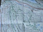
- Map #1 – Our route took us from the upper left corner to the lower right corner.
-

- Map #2
-
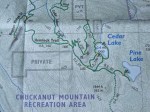
- Map #3
-

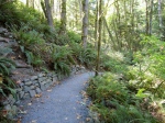
- North Chuckanut Mountain Trailhead
-

- Trail Sign
-
- Interurban Trail
-

- Doubletrack
-
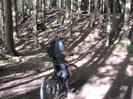
- Eric
-
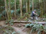
- Lower Salal Trail
-
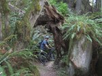
- Yes- those roots are the trail!

-
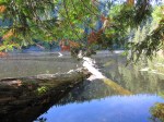
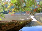
- Pine Lake
-
- Elisa at Pine Lake
-
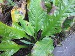
- Skunk Cabbage
-

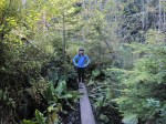
- Boards Around Pine Lake
-
- Pine Lake
-

- Eric at Pine Lake Camp
-

- Pine Lake
-

- Rosy Spirea
-
- Pine Lake
-
- Pine Lake
-
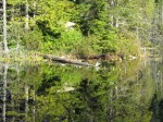
- Pine Lake
-

- Pine Lake
-
- Pine Lake

-
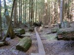
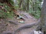
- Cedar Lake Boards
-

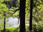
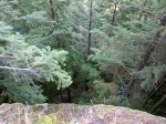
- Trees at Cedar Lake
-
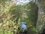
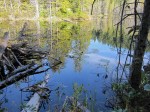
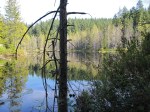
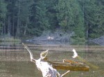
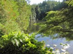
- Cedar Lake
-

- Cedar Lake
-
- Cedar Lake

-
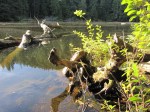
- Cedar Lake
-
- Dragon Fly at Cedar Lake
-
- Eric
-

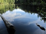
- Cedar Lake
-
- Cedar Lake

-

- Dragon Fly
-
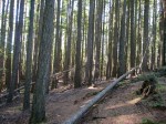
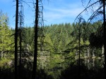
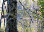
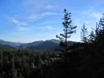
- Forest above Cedar Lake
-
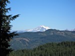
- Mt Baker from Cedar Lake Viewpoint
-
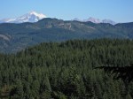
- Mt Baker & The Sisters
-
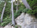
- No Fall Zone
-

- Mt Baker & The Sisters
-

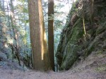
- The steep and rocky climb to Raptor Ridge
-
- Raptor Ridge Viewpoint
-

- Raptor Ridge Viewpoint
-
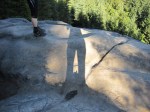
- Shadows
-
- No Fall Zone
-

- Eric at Raptor Ridge
-
- Eric at Raptor Ridge
-

- New trail at Raptor Ridge
-
- New trail at Raptor Ridge
-

- Sign for the new trail
-
- Elisa– happy!
-

- Veggie Burrito at Dos Padres
-
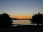
- Bellingham Sunset


5 comments
Comments feed for this article
November 20, 2013 at 12:26 PM
Felix
What is the name or where can I get that map you posted photos of? It appears to show some trails that I don’t have on my maps, but they go off camera for the sections you posted (the trail from pine to mud lake). Would you be willing to retake a photo of the map and email it to me? I’ll be up in the ‘ham next week and look to run up there.
November 20, 2013 at 7:14 PM
freeheelvegan
Felix..I am trying to locate my map. For some reason I can’t find it yet. I’ll keep looking and send you a pic ASAP. Thanks for the visit!
November 20, 2013 at 10:10 PM
felix
awesome! does the comments system give you access to my email address?
November 21, 2013 at 6:31 AM
freeheelvegan
yes it does
November 24, 2013 at 10:47 AM
freeheelvegan
The map is called Chuckanut Recreation Area, by Square One Maps.