You are currently browsing the tag archive for the ‘fireweed’ tag.
Saturday, August 24, 2013 – Mountain Biking
This was our second time riding the Crystal Mountain Trail #1163, to the top of the Crystal Mountain ski resort.
The first time we rode there was July 31, 2010. That was one of those picture-perfect days! The views of Mt Rainier are not to be missed!
Despite having a summer strung together with days and days of clear skies, the weather on this particular Saturday was not so cooperative. It was raining when we left the house. At the trailhead it was dry, but cloudy. We saw initial glimmers of blue sky as we climbed the forest, but by the time we arrived at the top, the fog was thick! And, Brrrr!!– it was not warm! Our fingers got cold on the descent.
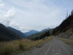
We drive here via Enumclaw, WA and Hwy 410 (Chinook Pass Hwy), which follows the White River. Turn off Hwy 410 at Rd #7190 (Crystal Mountain Blvd) and find the trailhead for Crystal Mountain Trail #1163 adjacent to Sand Flat Horse Camp. It is located about 2 miles short of the the ski resort itself.
This trip is a relatively short, “out-and-back” ride for us. We turn around at the top of the Mt Rainier Gondola/Summit House. Note that Trail #1163 does continue down from that highpoint (6872 ft) to intersect with other trails.
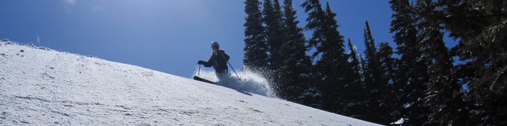
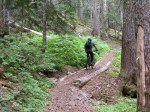
In a nutshell, this trail simply goes up and up and up for about 3000 ft. Consider this climb “interval training” because you won’t stay in your Zone 2. The tread is basically smooth, with some sections of jagged rocks (not too many) and some sandy patches. It’s quite rideable throughout. The descent is screamin’ fast!
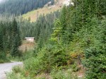
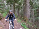
CLIMBING THE FOREST–> Switchbacks through trees and open slide paths of huckleberry bushes.

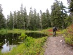
Ascending forest – August 24, 2013

Ascending forest – August 24, 2013

Blue skies on July 31, 2010
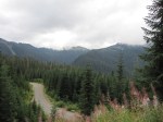
CLIMBING CRYSTAL MOUNTAIN RIDGE–> At times, the trail hugs a steep sidehill. It’s not too “airy,” but you do need to focus in couple places. The trail up the ridge also traverses a wide wildflower meadow.
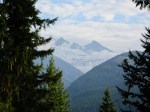
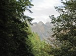
From the ridge, the BIG view is Mt Rainier. The White River is quite impressive as well.

Ridge climb – July 31, 2010

Meadow – July 31, 2010

Mt Rainier from Crystal Mountain Ridge – July 31, 2010

Eric – July 31, 2010

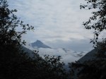
White River & clouds hiding Mt Rainier – August 24, 2013

White River & Mt Rainier – July 31, 2010

Looking east – July 31, 2010

Elisa – July 31, 2010

Elisa – July 31, 2010
ENTERING THE CRYSTAL MOUNTAIN SKI AREA–> Singletrack trail is replaced by a rocky road on the final uphill traverse to the top of the Mt Rainier Gondola and Summit House.

Headed toward the Northway Chairlift – August 24, 2013

Aster & Fireweed – August 24, 2013

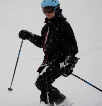
Eric wearing his #NSNG technical tee – August 24, 2013

Looking into the ski area – August 24, 2013

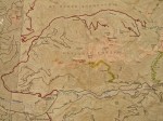
Crystal Mountain ski area map – August 24, 2013
THE TOP–> Views of fog!

Mt Rainier Gondola & the top of the Rainier Express chair – August 24, 2013

If you don’t want to power yourself to the top, you can pay $20 to ride the gondola.
Here is a link to the Crystal Mountain Summer Map. Note that this map calls the north section of the Crystal Mountain Trail #1163, “Northway Trail.”
—————————————
TRIP STATS: (Using the Bike Tracks App for iPhone)
- Total Distance = 11.6 miles
- Total Vertical = 5991 ft (climb 3053 ft, descend 2938 ft)
- Elevation = 6849 ft highest, 3818 ft lowest
- Time = 3 hrs, 39 min (start 11:10 AM, finish 2:46 PM)
MAPS USED:
FOOD CONSUMED ON TRAIL:
- Water + 1 SaltStick
- We didn’t even eat one huckleberry although the bushes were packed!
Canyon Creek & Damfino Lakes – Mountain Biking – September 29, 2012
Canyon Ridge Trail (#689) was our intended mountain bike ride for the day. Eric had been wanting to check it out because it’s the only trail in the Mt. Baker Ranger District open to mountain bikes. This trail is just a “stone’s throw” from Canada, immediately north of Mt Baker, in Washington State.
On our Green Trails map (#13, Mt Baker), Canyon Ridge is a dotted line trail, which can be code for “bushwhack.” As such, I started the day with an attitude of adventure, thinking that any “good” riding would be a “bonus.”
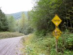
Little did we know that our adventure would start sooner rather than later. Right at the highway, the Canyon Creek Road (#31) was CLOSED. What?!
We found out from the ranger at the Glacier Public Service Center that the road had actually been closed for 2 years because of a partial road washout. (That shows you how often we frequent the Mt Baker highway!) When we got home, I found this page on the Forest Service website, showing the list of road conditions.
Instead of going elsewhere, we decided to ride up the road to see what was up there. As I have done before, I called this a “Gratitude Saturday.” To me, that means I’m open to how the day will unfold, instead of trying to make it live up to preconceived plans. It also means that I feel particularly content and appreciative of the “little” things. On this day, I loved just being on my bike, with my husband, in the mountains, under the trees, next to the creeks, and among the critters. Bliss 🙂
Canyon Creek Road (#31) leaves the Mt Baker Highway 542 at about 900 ft elevation. It terminates at 4200 ft elevation. The trailhead for Canyon Ridge Trail (#689) and Damfino Lakes Trail (#625) is located at road’s end.
We ended up biking the entire 15 mile road…a workout! About the first third was paved. The middle section alternated between pavement and gravel. The final third was gravel. By the time we got to the trailhead, we decided that the destination for the day would be Damfino Lakes rather than Canyon Ridge.
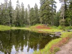
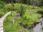
The short, 0.8 mile trail to Damfino Lakes (#625) was in surprisingly decent shape for being essentially cut off from the majority of civilization. (Although we did see motorcycle traffic that day). The trail climbed 400 ft. The lakes were small, but beautiful.
In these pictures, you will see some of the “little” things that I photographed during the day, with gratitude:
- Grey-blue glacial water flowing in the N. Fork Nooksack River
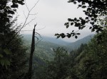
- Peek-a-boo views of the Canyon Creek Valley
- Fields of fireweed in a clearcut (I just had to imagine how intense the color must have been when it was all blooming)
- Old logging signage from the 1950’s
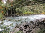
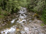
- Canyon Creek as it parallels the road
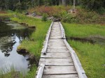
- Bridges, flowers, mountains, valleys, patches of snow
- Damfino Lakes
- Glimpses of Mt Baker
[Click on an image to enlarge and view in a photo gallery]
-
- Green Trails map of Canyon Creek Road
-

- Green Trails map of Damfino Lakes
-
- Glacier Public Service Center

-
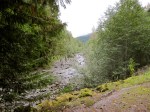
- N. Fork Nooksack River
-

- N. Fork Nooksack River

-

- Canyon Creek Road Closed
-

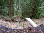
- Canyon Creek Road partial washout at ~1 mile


-

- Eric in the clearcut


-

- Old logging sign
-

- Canyon Creek

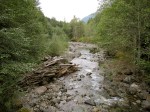
-

- Bridge near Canyon Creek Camp


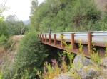
-

- Whistler Creek Valley

-

- Excelsior Ridge
-

- Bumble Bees

-
- Near the end of Canyon Creek Road


-

- Eric on Damfino Lakes Trail

-
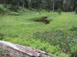
- Damfino Lake #1
-

- Looking toward Damfino Lake #2

-

- Damfino Lake #2


-

- Damfino Lake #3


-

- Elisa at Damfino Lakes


-

- Bald Mountain
-

- Mt Baker
-

- Mt Baker
-
- Mt Baker
-
- Church Mountain
-
- Mt Baker
-

- Church Mountain