You are currently browsing the category archive for the ‘GET OUT & LIVE LIFE’ category.
North Chuckanut Mountain Trails – Mountain Biking – October 6, 2012
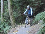
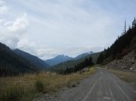
Saturday was a perfect, autumn day for mountain biking in the Chuckanut Mountains. On a clear day like this, we were treated with unobstructed views of Mt Baker from the Cedar Lake viewpoint. This trail system is located just south of the Fairhaven neighborhood of Bellingham, WA. The Chuckanut mountains are tucked between Chuckanut Bay to the west, and I-5 to the east. They reach a high point of about 1850 ft.
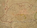
Our route: (~12 miles round trip, 4 1/2 hours)
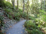
- NORTH CHUCKANUT TRAILHEAD to INTERURBAN TRAIL to LOWER SALAL TRAIL. This section is fun, both up and down. The path is mostly smooth gravel, smooth dirt, and a short section of doubletrack.
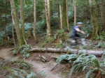
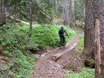
- LOWER SALAL TRAIL and SALAL TRAIL to HEMLOCK TRAIL. These trails vary from “rideable rooty/rocky” to highly technical, “get off your bike and push.” NOT for beginners. Be careful if descending this trail. (We saved it for another time.) I’m just imagining what all the roots would be like when wet…
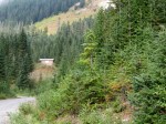
- HEMLOCK TRAIL to PINE LAKE. A relentless climb, with some places where you lose and gain elevation. Get your workout on!
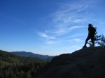
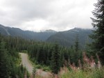
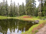
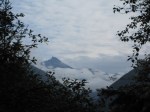
- PINE LAKE to CEDAR LAKE and the CEDAR LAKE VIEWPOINT. We enjoyed watching the dragonflies buzzing over Cedar Lake. Around the lake, you will be off your bike more than on. The view of Mt Baker and the Sisters on a clear day is worth the climb to the viewpoint. Be careful that you don’t fall off the ledge!
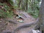
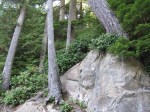
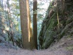
- HEMLOCK TRAIL to RAPTOR RIDGE VIEWPOINT. This section is way steep and rocky…Try to enjoy the push! The rocky viewpoint is another no-fall zone. There are no views of Mt Baker from here. Not recommended for small children or clumsy/intoxicated adults!
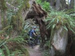
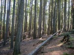
- RAPTOR RIDGE VIEWPOINT to a new, unmarked trail, down to NORTH LOST LAKE TRAIL. The new, unmarked trail was definitely the highlight of the day 🙂 . This was totally worth the effort to get there…a blast of a descent. Will repeat!!
- NORTH LOST LAKE TRAIL to INTERURBAN TRAIL and NORTH CHUCKANUT TRAILHEAD. The North Lost Lake trail is a long, fast descent on a seemingly never-ending doubletrack. The final section of singletrack (mentioned above) gets you back to the car with a smile on your face.
After the ride, we ate veggie fajitas/veggie burritos for dinner at Dos Padres, in Fairhaven. That was the first restaurant we went out to eat together…21 years ago! (We met each other at Western Washington University (WWU).) The sunset in Bellingham was worth one last picture.
[Click on an image to enlarge and view in a photo gallery]
-
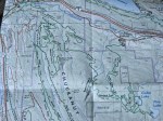
- Map #1 – Our route took us from the upper left corner to the lower right corner.
-

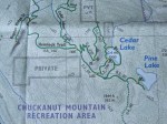
- Map #2
-
- Map #3
-

- North Chuckanut Mountain Trailhead
-

- Trail Sign
-
- Interurban Trail
-

- Doubletrack
-
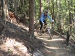
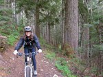
- Eric
-
- Lower Salal Trail
-
- Yes- those roots are the trail!

-
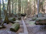
- Pine Lake
-
- Elisa at Pine Lake
-
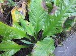
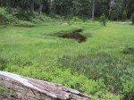
- Skunk Cabbage
-

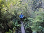
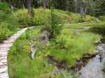
- Boards Around Pine Lake
-
- Pine Lake
-

- Eric at Pine Lake Camp
-

- Pine Lake
-

- Rosy Spirea
-
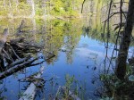
- Pine Lake
-
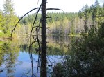
- Pine Lake
-
- Pine Lake
-

- Pine Lake
-
- Pine Lake

-
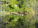
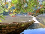
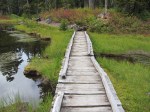
- Cedar Lake Boards
-

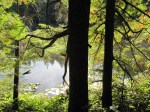
- Trees at Cedar Lake
-
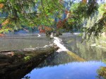
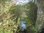
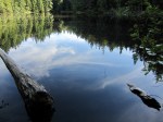
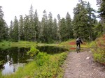
- Cedar Lake
-

- Cedar Lake
-
- Cedar Lake

-
- Cedar Lake
-
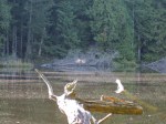
- Dragon Fly at Cedar Lake
-
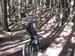
- Eric
-

- Cedar Lake
-
- Cedar Lake

-

- Dragon Fly
-
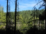
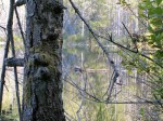
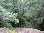
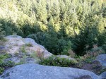
- Forest above Cedar Lake
-
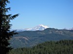
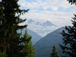
- Mt Baker from Cedar Lake Viewpoint
-
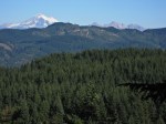
- Mt Baker & The Sisters
-
- No Fall Zone
-

- Mt Baker & The Sisters
-

- The steep and rocky climb to Raptor Ridge
-
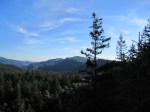
- Raptor Ridge Viewpoint
-

- Raptor Ridge Viewpoint
-
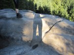
- Shadows
-
- No Fall Zone
-

- Eric at Raptor Ridge
-
- Eric at Raptor Ridge
-

- New trail at Raptor Ridge
-
- New trail at Raptor Ridge
-

- Sign for the new trail
-
- Elisa– happy!
-

- Veggie Burrito at Dos Padres
-
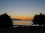
- Bellingham Sunset
Canyon Creek & Damfino Lakes – Mountain Biking – September 29, 2012
Canyon Ridge Trail (#689) was our intended mountain bike ride for the day. Eric had been wanting to check it out because it’s the only trail in the Mt. Baker Ranger District open to mountain bikes. This trail is just a “stone’s throw” from Canada, immediately north of Mt Baker, in Washington State.
On our Green Trails map (#13, Mt Baker), Canyon Ridge is a dotted line trail, which can be code for “bushwhack.” As such, I started the day with an attitude of adventure, thinking that any “good” riding would be a “bonus.”
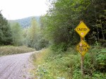
Little did we know that our adventure would start sooner rather than later. Right at the highway, the Canyon Creek Road (#31) was CLOSED. What?!
We found out from the ranger at the Glacier Public Service Center that the road had actually been closed for 2 years because of a partial road washout. (That shows you how often we frequent the Mt Baker highway!) When we got home, I found this page on the Forest Service website, showing the list of road conditions.
Instead of going elsewhere, we decided to ride up the road to see what was up there. As I have done before, I called this a “Gratitude Saturday.” To me, that means I’m open to how the day will unfold, instead of trying to make it live up to preconceived plans. It also means that I feel particularly content and appreciative of the “little” things. On this day, I loved just being on my bike, with my husband, in the mountains, under the trees, next to the creeks, and among the critters. Bliss 🙂
Canyon Creek Road (#31) leaves the Mt Baker Highway 542 at about 900 ft elevation. It terminates at 4200 ft elevation. The trailhead for Canyon Ridge Trail (#689) and Damfino Lakes Trail (#625) is located at road’s end.
We ended up biking the entire 15 mile road…a workout! About the first third was paved. The middle section alternated between pavement and gravel. The final third was gravel. By the time we got to the trailhead, we decided that the destination for the day would be Damfino Lakes rather than Canyon Ridge.
The short, 0.8 mile trail to Damfino Lakes (#625) was in surprisingly decent shape for being essentially cut off from the majority of civilization. (Although we did see motorcycle traffic that day). The trail climbed 400 ft. The lakes were small, but beautiful.
In these pictures, you will see some of the “little” things that I photographed during the day, with gratitude:
- Grey-blue glacial water flowing in the N. Fork Nooksack River
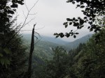
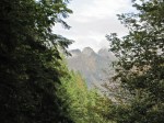
- Peek-a-boo views of the Canyon Creek Valley
- Fields of fireweed in a clearcut (I just had to imagine how intense the color must have been when it was all blooming)
- Old logging signage from the 1950’s
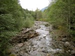
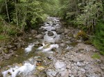
- Canyon Creek as it parallels the road
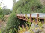
- Bridges, flowers, mountains, valleys, patches of snow
- Damfino Lakes
- Glimpses of Mt Baker
[Click on an image to enlarge and view in a photo gallery]
-
- Green Trails map of Canyon Creek Road
-

- Green Trails map of Damfino Lakes
-
- Glacier Public Service Center

-
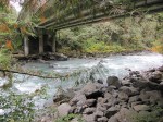
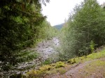
- N. Fork Nooksack River
-

- N. Fork Nooksack River

-

- Canyon Creek Road Closed
-

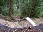
- Canyon Creek Road partial washout at ~1 mile


-

- Eric in the clearcut


-

- Old logging sign
-

- Canyon Creek

-

- Bridge near Canyon Creek Camp


-

- Whistler Creek Valley

-

- Excelsior Ridge
-

- Bumble Bees

-
- Near the end of Canyon Creek Road


-

- Eric on Damfino Lakes Trail

-
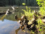
- Damfino Lake #1
-

- Looking toward Damfino Lake #2

-

- Damfino Lake #2


-

- Damfino Lake #3


-

- Elisa at Damfino Lakes


-

- Bald Mountain
-

- Mt Baker
-

- Mt Baker
-
- Mt Baker
-
- Church Mountain
-
- Mt Baker
-

- Church Mountain